SMA26 RTK GPS Tripod, Pole Tribrach SMAJAYU Price Online | Shop The World
From USA
NewSMAJAYU
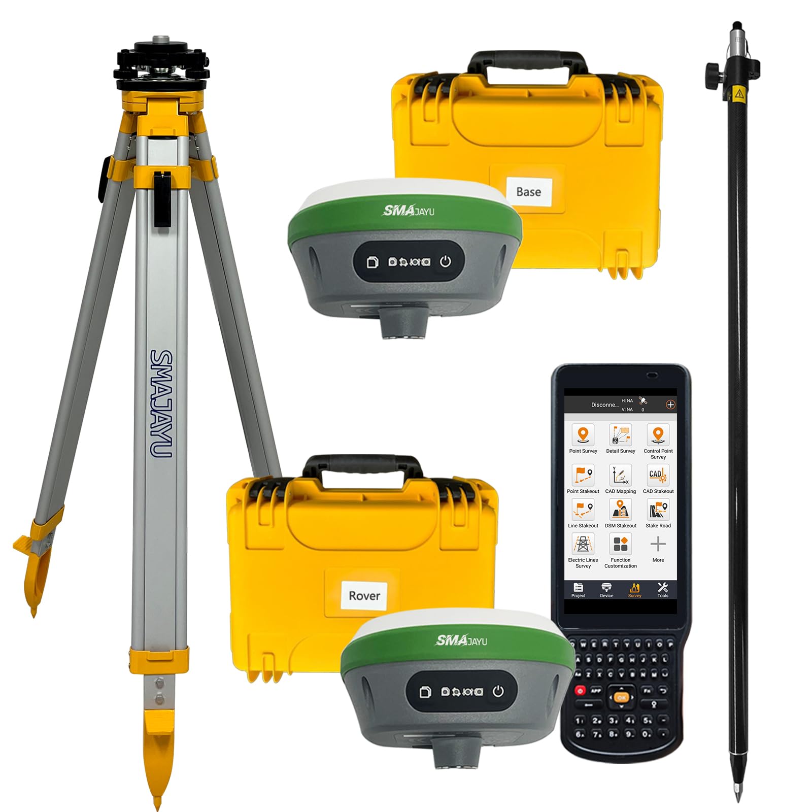
SMA26 RTK GPS with Tripod, Pole and Tribrach
ℹ
Products from the USA may come with an input voltage of 110V–120V, requiring a step-down transformer. Check the device wattage to select the correct power converter.
•【Advantages】 ①NOAA: SMA26 antenna is NOAA certificated which adapt for US National spatial reference system and other standard post-processed software. ②Data output format: Differential data: RTCM3.X, Location data: NMEA-0183, Static data: Binary which can be converted to Rinex. ③PPP method: PPP method by Galileo HAS correction, ④PPK is Upgradeable in near future, which can make static during base mode. ⑤CORS network connection supported by login a CORS account on collector.
•⑥Connection by: BT/WiFi/USB-Type-C/TNC Connector/Serial Port(DB9 cable optional) ⑦Multiple constellation adaptable to any country and suitable for use in various complex and challenging environments: - GPS L1C/A/L2P(Y)/L2C /L5 - GLONASS G1/G2/G3- BDS B1I/B2I/B3I/B1C/B2a/B2b* - GALILEO E1/E5a/E5b /E6* - QZSS L1, L2, L5.
•【Capability】RTK GPS Land surveying equipment Rover+Base+ Collector(Software permanent valid) ①1cm RTK accuracy and Full-Frequency and Full-Constellation ②5-10km UHF distance between rover and base. ③30°-60° IMU tilt measurement with centimeters accuracy ④2 working days battery life each charge. ⑤10cm accuracy by PPP method, no need base station. ⑥2.5cm accuracy by CORS network station.
•【RTK Connection】 Rover+Base:Connect Collector with GNSS receiver by WIFI on WEBUI or BT to set rover and base at the same protocol and frequency till RTK fixed. Or Rover+CORS: login CORS account on software till RTK fixed.
•【Application】 The R26 RTK GNSS receiver provides the accuracy needed for a wide range of surveying and engineering applications, including topographic surveying, geographic surveying, engineering surveying, agriculture field measurement, mine surveying, construction surveying ...